Interrupted Goode Homolosine
Classification |
Pseudocylindrical |
Available forms |
Forward and inverse, spherical projection |
Defined area |
Global |
Alias |
igh |
Domain |
2D |
Input type |
Geodetic coordinates |
Output type |
Projected coordinates |
proj-string: +proj=igh
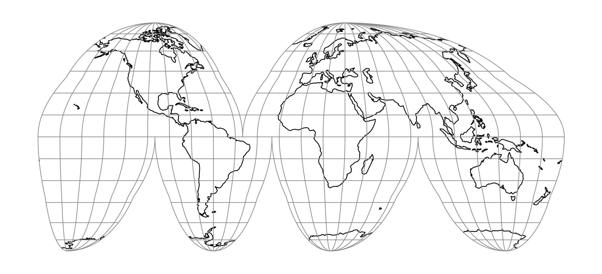
The Interrupted Goode Homolosine projection is an equal-area composite
projection intended for making world maps. Low latitudes are comprised of six
separate Sinusoidal projection regions, and high latitudes are comprised of
six separate Mollweide (homolographic) projections. The transition latitude
is at 40d 44' 11.8", where the Sinusoidal and Mollweide scales are equal. The
lobes in this projection are chosen to emphasize the land area of the Earth. This
projection was first published in 1925 by J. P. Goode [Goode1925].
Parameters
Note
All parameters are optional for the projection.
- +lon_0=<value>
Central meridian/longitude of natural origin, longitude of origin or longitude of false origin (naming and meaning depend on the projection method).
Defaults to 0.0.
Note
The default convention is to interpret this value as decimal degrees. To specify radians instead, follow the value with the "r" character.
Example: +lon_0=1.570796r
See Projection Units for more information.
- +R=<value>
Radius of the sphere, given in meters. If used in conjunction with
+ellps,+Rtakes precedence.See Ellipsoid size parameters for more information.
- +x_0=<value>
False easting, easting at false origin or easting at projection centre (naming and meaning depend on the projection method). Always in meters.
Defaults to 0.0.
- +y_0=<value>
False northing, northing at false origin or northing at projection centre (naming and meaning depend on the projection method). Always in meters.
Defaults to 0.0.